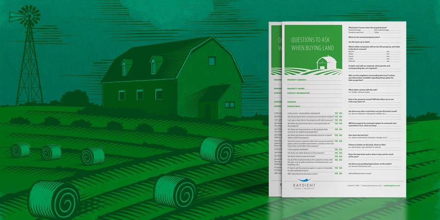
A rural community with land for sale in Baker County, Florida ranging from +/-10.3 to +/-11.8 acres

Starting At
$124,900
Lots
20
Acreage
+/-10.3 - +/-11.2 Acres
Interested? Contact the Broker
Brandi Rhoden Volz
Brandi Rhoden Volz
Thomas R Rhoden Agency Inc.
Bio
Slide to the right
Steel Bridge - 14 photos
Close X
Steel Bridge - of 14
Close X
Steel Bridge Featured
Steel Bridge Sign
Steel Bridge Corner
Steel Bridge Gate Open 2
Steel Bridge Land
Steel Bridge Gate
Steel Bridge Land 4
Steel Bridge Gate Dirt
Steel Bridge Land 3
Steel Bridge Gate Open
Steel Bridge Land 2
Steel Bridge Land 5
Steel Bridge Road Dirt
Steel Bridge Road Paved

Community Lots

Lot Number
Acres
Status
Contact
Add'l Info
Lot Number: 6
Acres: 10.5
Status: Available
Lot Number: 7
Acres: 10.5
Status: Available
Lot Number: 8
Acres: 10.3
Status: Available
Lot Number: 9
Acres: 11.2
Status: Available
Lot Number: 1
Acres: 11.3
Status: Sold

Community Overview

Set amidst a stately pine and hardwood forest and just minutes from the St. Mary’s River, Steel Bridge boasts 20 lots ranging from 10+/- to 17+/- acres. Bring your family, animals, ATVs, RVs, golf carts and boats! 

These secluded lots front paved and unpaved, county-maintained roads with overhead power and offer private gated entrances, driveways and enhanced entryway fencing. Thoughtful deed restrictions protect your investment while allowing you to create your country home oasis. 

Secluded yet convenient, Steel Bridge is approximately 345 minutes to Jacksonville and Lake City, minutes to downtown Macclenny, an hour from Jacksonville International Airport, and a mile to the St. Mary’s Cove public boat ramp. Come discover the best of urban, small-town, and rural amenities in Macclenny, Florida.

PROXIMITIES
6 miles to Macclenny
36 miles to Jacksonville
40 miles to Lake City
45 miles to Jacksonville International Airport

Community Amenities & Benefits

Paved Road Frontage
Paved Road Frontage
Dirt Road Frontage
County Maintained Dirt Road Frontage
Protective Covenants
Protective Community Covenants
Gated Entrance
Gated Entrance with Fence
Private Driveway
Private Driveway
City Proximity
Proximity to City
Survey Corners
Accurate Survey with Boundaries Marked
Electricity Available
Steel Bridge Logo
Steel Bridge - Lot 1
+/-11.3 Acres
Baker County, Florida 32063
Road Frontage: Steel Bridge Road
Latitude: 30.3501779311782
Longitude: -82.088414448116
Utilities: Well and septic needed
Steel Bridge Logo
Steel Bridge - Lot 2
+/-10.3 Acres
Baker County, Florida 32063
Road Frontage: Steel Bridge Road
Latitude: 30.3507741061846
Longitude: -82.087630548032
Utilities: Well and septic needed
Steel Bridge Logo
Steel Bridge - Lot 3
+/-10.3 Acres
Baker County, Florida 32063
Road Frontage: Steel Bridge Road
Latitude: 30.3514362314929
Longitude: -82.0868228829736
Utilities: Well and septic needed
Steel Bridge Logo
Steel Bridge - Lot 4
+/-10.2 Acres
Baker County, Florida 32063
Road Frontage: Steel Bridge Road
Latitude: 30.3542605823572
Longitude: -82.0870017117567
Utilities: Well and septic needed
Steel Bridge Logo
Steel Bridge - Lot 5
+/-10.9 Acres
Baker County, Florida 32063
Road Frontage: Stokes Road
Latitude: 30.3555536555091
Longitude: -82.0865501979431
Utilities: Well and septic needed
Steel Bridge Logo
Steel Bridge - Lot 6
+/-10.5 Acres
Baker County, Florida 32063
Road Frontage: Stokes Road
Latitude: 30.3566376872277
Longitude: -82.0866030241963
Utilities: Well and septic needed
Steel Bridge Logo
Steel Bridge - Lot 7
+/-10.5 Acres
Baker County, Florida 32063
Road Frontage: Stokes Road
Latitude: 30.3576611029208
Longitude: -82.0865902975835
Utilities: Well and septic needed
Steel Bridge Logo
Steel Bridge - Lot 8
+/-10.3 Acres
Baker County, Florida 32063
Road Frontage: Stokes Road
Latitude: 30.3586532409568
Longitude: -82.0865566329443
Utilities: Well and septic needed
Steel Bridge Logo
Steel Bridge - Lot 9
+/-11.2 Acres
Baker County, Florida 32063
Road Frontage: LE Wilkerson Road
Latitude: 30.357203165397
Longitude: -82.0842570763987
Utilities: Well and septic needed
Steel Bridge Logo
Steel Bridge - Lot 10
+/-13.7 Acres
Baker County, Florida 32063
Road Frontage: Steel Bridge Road
Latitude: 30.3528509970023
Longitude: -82.085303500816
Utilities: Well and septic needed
Steel Bridge Logo
Steel Bridge - Lot 11
+/-11.8 Acres
Baker County, Florida 32063
Road Frontage: Steel Bridge Road
Latitude: 30.3521580717901
Longitude: -82.0850144583824
Utilities: Well and septic needed
Steel Bridge Logo
Steel Bridge - Lot 12
+/-14.8 Acres
Baker County, Florida 32063
Road Frontage: St Marys Cove Road
Latitude: 30.3494707403806
Longitude: -82.0849657430171
Utilities: Well and septic needed
Steel Bridge Logo
Steel Bridge - Lot 13
+/-11.1 Acres
Baker County, Florida 32063
Road Frontage: Steel Bridge Road
Latitude: 30.3492902923488
Longitude: -82.0842379908258 -
Utilities: Well and septic needed
Steel Bridge Logo
Steel Bridge - Lot 14
+/-12 Acres
Baker County, Florida 32063
Road Frontage: St Marys Cove Road
Latitude: 30.3488737932401
Longitude: -82.0831609324972
Utilities: Well and septic needed
Steel Bridge Logo
Steel Bridge - Lot 15
+/-16.4 Acres
Baker County, Florida 32063
Road Frontage: St Marys Cove Road
Latitude: 30.35149736921
Longitude: -82.0819002580199
Utilities: Well and septic needed
Steel Bridge Logo
Steel Bridge - Lot 16
+/-10.3 Acres
Baker County, Florida 32063
Road Frontage: St Marys Cove Road
Latitude: 30.3497037041157
Longitude: -82.0779959275983
Utilities: Well and septic needed
Steel Bridge Logo
Steel Bridge - Lot 17
+/-10.1 Acres
Baker County, Florida 32063
Road Frontage: St Marys Cove Road
Latitude: 30.3494612114834
Longitude: -82.0762197603797
Utilities: Well and septic needed
Steel Bridge Logo
Steel Bridge - Lot 18
+/-10.1 Acres
Baker County, Florida 32063
Road Frontage: St Marys Cove Road
Latitude: 30.3497097968396
Longitude: -82.0750267889005
Utilities: Well and septic needed
Steel Bridge Logo
Steel Bridge - Lot 19
+/-10.1 Acres
Baker County, Florida 32063
Road Frontage: St Marys Cove Road
Latitude: 30.3499989236431
Longitude: -82.0738542159152
Utilities: Well and septic needed
Steel Bridge Logo
Steel Bridge - Lot 20
+/-10.1 Acres
Baker County, Florida 32063
Road Frontage: St Marys Cove Road
Latitude: 30.3502625444077
Longitude: -82.0726726242756
Utilities: Well and septic needed
Checklist Resource (1)
Free Checklist

Questions to Ask When Buying Land

Ready to visit rural properties? Keep track of the facts for each tract and ask the right questions with this handy one-page checklist.

Download
Disclaimer

PRICE IS SUBJECT TO CHANGE WITHOUT NOTICE. PHOTOGRAPHS AND DRAWINGS ARE AN ARTIST’S CONCEPTION AND ARE NOT INTENDED TO SHOW SPECIFIC DETAILING. PHOTOGRAPHS AND DRAWINGS MAY NOT BE TO SCALE, ARE NOT NECESSARILY A REPRESENTATION OF PROPERTY, AND ARE SUBJECT TO CHANGE WITHOUT NOTICE. THE INFORMATION CONTAINED HEREIN, INCLUDING BUT NOT LIMITED TO, THE RATING OF THE SCHOOL DISTRICT, AND THE EXISTENCE OF SURROUNDING LANDMARKS ARE SUBJECT TO CHANGE. THE PARCEL OWNER AND ITS AFFILIATES PUT THE POTENTIAL BUYER ON NOTICE THAT THE PRESENT CONDITION AND FUTURE USE OF THE PROPERTY IS REGULATED BY A VARIETY OF SOURCES. FUTURE POTENTIAL USES OF THE PROPERTY MAY BE AFFECTED BY LOCAL, STATE AND FEDERAL REGULATIONS INCLUDING, BUT NOT LIMITED TO: ZONING REGULATIONS, WETLAND JURISDICTIONAL AREA REGULATIONS, COMPREHENSIVE PLAN RESTRICTIONS, FUTURE LAND USE MAP DESIGNATIONS, TITLE ENCUMBRANCES, ETC. IT IS THE POTENTIAL BUYER'S SOLE RESPONSIBILITY TO DETERMINE THE PRESENT CONDITION AND FUTURE ALLOWABLE USES OF THE PROPERTY. THE PARCEL OWNER AND ITS AFFILIATES ARE UNDER NO OBLIGATION TO CONSTRUCT OR INSTALL ANY FACILITY OR IMPROVEMENT. NO REPRESENTATION IS MADE WITH RESPECT TO THE VALUE OF THE PROPERTY DESCRIBED HEREIN OR WHETHER THE PROPERTY SHOULD BE USED AS AN INVESTMENT. ORAL REPRESENTATIONS CANNOT BE RELIED UPON AS CORRECTLY STATING THE REPRESENTATIONS OF EITHER THE PARCEL OWNER OR ITS AFFILIATES. FOR CORRECT REPRESENTATIONS, REFERENCE SHOULD BE MADE TO THE PURCHASE CONTRACT. THIS IS NOT AN OFFERING IN ANY STATE WHERE PROHIBITED OR OTHERWISE RESTRICTED BY LAW.